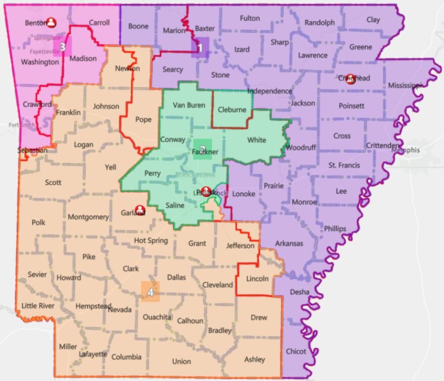
The Arkansas Legislature has given final approval to a re-drawn map of the state’s four U.S. congressional districts that splits Pulaski County among three districts. The proposed map now awaits a signature from Gov. Asa Hutchinson.
With little debate, members of the state House and Senate passed identical versions of the map on Thursday. House Bill 1982, sponsored by Rep. Nelda Speaks, R-Mountain Home, passed the Senate by a vote of 21 to 12. Shortly afterward, the House approved Senate Bill 743, sponsored by Sen. Jane English, R-North Little Rock, on a vote of 53 to 35.
The proposal would trisect Pulaski County among the 1st, 2nd and 4th congressional districts. Most of Little Rock would remain in the 2nd District, while areas on the southeast edge of the city would go to the 4th District, currently represented in the U-S House by Republican Bruce Westerman. All of Pulaski County is currently in the 2nd District, represented by Republican French Hill of Little Rock.
Maumelle, Sherwood, Jacksonville and most of North Little Rock would also remain in the 2nd District, though the eastern edge of North Little Rock would go to the 1st district, represented by Republican Rick Crawford. Unincorporated parts of southern and eastern Pulaski County would go to the 4th and 2nd Districts, respectively.
Critics of the proposal have said it seeks to dilute the voting power of minority communities in central Arkansas. While the governor has not indicated whether he will approve the map, Hutchinson said Wednesday he does not support any redistricting proposals that dilute minority districts.


